GPS+ Maps, Navigation, Traffic
- 4.5
- Rating
- 10.00M
- Installs
- Free
- Price

 Analysis by App-foxy
I tend to judge navigation apps by what happens when a journey becomes inconvenient: a road closes, mobile coverage weakens, traffic suddenly builds, or I need to change the route without taking my attention away from driving. GPS+ Maps, from JVSTUDIOS, is aimed at those moments. It is a free Maps & Navigation app for Android, with live traffic information and offline maps at the center of its appeal. After using it as a practical route-planning tool, I found it most interesting not because it tries to replace every travel app on a phone, but because it combines everyday guidance with a fallback for areas where connectivity cannot be trusted.
The app has been available since December 23, 2016, and its current version is 4.0.46. It supports Android 9 and newer, carries an Everyone content rating, and has grown to over 10 million installs. Its average score is 4.6 from around 330,000 ratings, with roughly 2,900 written reviews. Those numbers suggest that it has found a broad audience, but they do not remove the need to test whether its particular approach fits the way you travel. Navigation is personal: a commuter, a delivery driver, a holiday traveler, and a person who only needs occasional directions can all want different things from the same screen.
Why GPS+ Maps earns trust, and where that trust needs checking
My first impression is that GPS+ Maps makes a sensible promise: keep the route visible, show traffic while it matters, and give you a way to continue when the internet is unreliable. That combination is useful, but it also creates a trust question. A navigation app is not just a map on a screen. It can influence driving decisions, request access to location, and become part of routines that involve home addresses, workplaces, regular errands, and travel plans. I therefore pay attention to the choices the app presents, not only to how quickly it draws a route.
You May Also Like

 Blood Strike: 2.5 Anniversary
Blood Strike’s Loadouts Turn Every Drop Into a Tactical Gamble
A close look at Blood Strike’s custom loadouts: how fast access to signature weapons reshapes its battle royale rhythm, rewards preparation, and narrows the gap between fights.

 Pandora - Music & Podcasts
Pandora’s Music Is Easy to Start, but Harder to Recover
Pandora’s strength is its low-effort path from a seed to a station. Its weak spot is how much confidence it asks you to place in connection, setup, and quiet recovery.

 8 Ball Pool
 Is Built on Rivalries, Rematches, and Routine
A close look at the rivalries, rematches, shared routines, and unanswered safety questions that turn a quick pool match into a persistent mobile community.

 Samsung Music
’s Quiet Strength Is Playing What You Already Own
Its reach comes less from spectacle than from dependable access to a personal library. That simplicity is both the app’s strongest retention engine and its ceiling.

 AccuWeather: Weather Radar
AccuWeather Review: A Quick, Clear Forecast for Everyday Decisions
For everyday plans, the best forecast is the one you can understand quickly. AccuWeather makes rain timing, radar, and local conditions easy to act on, with a few trade-offs.

 Hill Climb Racing
Why Hill Climb Racing Still Turns Crashes Into One More Run
A tiny car, a bumpy hill and one more upgrade: Hill Climb Racing keeps resurfacing because its simple chaos makes every near-miss feel personal.
More From Our News Desk



The developer is listed as JVSTUDIOS, and the app is free to download. There are in-app purchases ranging from $0.99 to $49.99 per item, so I would not assume that every optional capability has the same cost or that the free experience is identical for every user. Before confirming a purchase, I would read the wording shown on the payment screen carefully and check which feature or service it unlocks. That is a small habit, but it matters more in a navigation app because people often install one in a hurry before a trip.
I also like that the app’s basic identity is easy to understand. It is not presented as a social network, a booking service, or a general travel marketplace. Its purpose is navigation, traffic awareness, and map access. That narrower role makes it easier for me to decide whether it belongs on my phone. At the same time, I would still review the permission prompts when installing it rather than accepting everything automatically. Location access is central to turn-by-turn guidance, but a careful user should understand when access is requested and choose the least intrusive option that still supports the intended use.
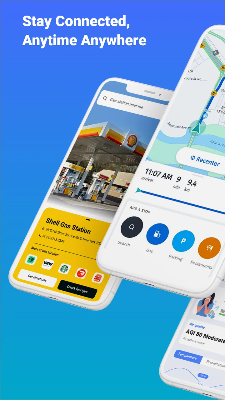
One practical trust test is to set up a short route before depending on the app for a long drive. Search for a familiar destination, inspect the proposed roads, and see whether the map remains understandable when you are not actively moving. This reveals more than a store description: you learn whether the visual hierarchy suits you, whether route changes are easy to find, and whether the app feels calm enough to use under pressure. I would also test it while stationary with mobile data unavailable, because offline maps are valuable only if they have been prepared before the signal disappears.
Offline planning is more than an emergency button
The offline map capability is the feature I would prepare first. Many people think of offline maps only as a rescue tool for remote roads, but I find them more useful as a deliberate travel workflow. Before leaving, I can plan the important parts of a journey while connected, make sure the relevant map area is available, and then reduce the risk of being surprised by a weak signal in a tunnel, rural stretch, underground car park, or foreign city. The key trade-off is that an offline map is a snapshot, while live traffic depends on current information. I would treat the offline map as route continuity, not as a replacement for changing road conditions.
That distinction affects how I would use it on a weekend trip. I would prepare the route and surrounding area at home, then check traffic shortly before departure. Once driving begins, the offline material gives me a useful safety net if connectivity fades, while the live view is more helpful before and during the connected part of the journey. If a major delay develops after the last traffic update, I would not blindly follow the original plan; I would stop safely and reassess. No navigation app should encourage a driver to treat its route as unquestionable.
Offline access also changes how I think about battery and data use. I would download what I actually need instead of preparing a huge region without a reason, and I would avoid repeatedly reopening the map just to watch the screen while parked. The benefit is greatest when it is planned around a real journey. For someone who only drives in a city with dependable coverage, the extra preparation may feel unnecessary. For a traveler crossing patchy-service areas, it can be the difference between a minor inconvenience and an anxious detour.
Live traffic helps, but it should not make decisions for you
Traffic information is most valuable when it changes a decision. If I am leaving for an appointment, I want to know whether the usual road has become slow enough to justify an alternative. If the app shows a delay, I can compare the suggested route with roads I already know rather than accepting a detour automatically. This is where GPS+ Maps can be more useful than a simple printed route or a basic map viewer: the route is not frozen at the moment I start the journey.
Still, traffic guidance has limits that are easy to overlook. A faster-looking route may include complicated turns, narrow streets, tolls, difficult parking, or roads that are unpleasant at a particular time of day. I would use the traffic layer as evidence, not as an instruction. For a familiar commute, I already know which delays are tolerable and which shortcuts create more stress than they save. For an unfamiliar city, I would give extra weight to road simplicity and safe stopping options, even if the estimated arrival time is slightly longer.
A useful habit is to compare the route before moving and then leave the phone alone unless the app gives a clear reason to reconsider. Constantly watching traffic colors can become distracting, especially when the route is already working. I prefer to make one decision while parked, start driving, and allow the app to handle ordinary guidance. If I need to investigate an alternative, I would pull over first. The quality of a navigation tool includes how safely I can use it, not only how detailed its map appears.
How it compares with familiar alternatives
Compared with a standard online map service, GPS+ Maps is most compelling for someone who values offline preparation and wants traffic information in the same navigation setup. A mainstream alternative may offer a broader ecosystem around places, reviews, transit, saved locations, and other daily services. If those extras are central to your routine, a larger platform may feel more convenient. GPS+ Maps makes more sense when the priority is getting from one place to another with a practical backup for lost connectivity.
Compared with a dedicated offline navigation app, GPS+ Maps has a different balance. An offline-first product may make map storage and disconnected travel its main identity, while GPS+ Maps also emphasizes live traffic. That combination is convenient, but it means I would pay attention to which parts of the experience remain useful without a connection and which depend on current data. People who spend most of their time far from reliable service should test the offline workflow thoroughly before making it their only navigation option.
Compared with a paper map or a preplanned route, the app is much better at adapting to a changing journey, but it can also reduce my awareness of the surrounding geography if I follow every instruction passively. I like to glance at the overall direction before setting off so I understand the shape of the trip. That makes it easier to recover if I miss a turn or decide to stop somewhere. The best use of GPS+ Maps, in my experience, is as a decision aid rather than a substitute for basic orientation.
Everyday use: a realistic commute and a weekend trip
Imagine leaving work on a rainy evening with a familiar drive ahead. Before starting the engine, I would check the traffic view, compare the normal route with any suggested alternative, and decide whether saving time is worth taking unfamiliar streets. If the usual road is moving normally, I would keep the simple route and avoid unnecessary changes. If congestion is heavy, I would examine the detour while parked, looking for a route that is understandable rather than merely fast. That small pause gives the app a useful role without letting it dominate the journey.
For a weekend trip, my process would be different. I would prepare the destination and nearby roads while connected, confirm that the offline map covers the areas I expect to visit, and then check traffic again before departure. I would also think about the return journey instead of assuming that the same route will work later. If I planned to explore side roads, I would keep the main destination available and avoid relying on live updates in places where service may be inconsistent. This is one of the app’s strongest practical use cases: preparation and live awareness complement each other when used for different purposes.
For a delivery worker or anyone making several stops, I would be more cautious. The app may help with individual routes, but efficiency depends on how easily you can organize multiple destinations, preserve attention, and recover from changes. I would test that workflow before committing to it for work. A casual driver can tolerate a little friction; someone whose income depends on repeated navigation needs a faster, more predictable process and should compare GPS+ Maps directly with a tool built around professional route management.
Permissions, data-sensitive moments, and user control
Location is the sensitive part of any navigation experience. When I use GPS+ Maps for active guidance, I expect location access to be relevant to the task. I would still review the permission dialog and the operating system’s controls, especially if I only need directions occasionally. On a personal phone, I prefer to grant access in a way that matches my actual use rather than leaving every permission untouched indefinitely. If the system offers a choice between different levels of location access, I would select the one that supports navigation without giving more access than I intend.
I would also be careful when entering places that reveal a routine, such as home, work, a school, or a medical appointment. Those destinations can be more sensitive than a one-time tourist attraction. I would avoid saving private locations unless the convenience genuinely outweighs the privacy concern, and I would periodically review saved places and any account settings the app presents. This is not a criticism unique to GPS+ Maps; it is a sensible practice for any app that helps build a picture of where I go.
The same caution applies to purchases. The free price makes it easy to try the app without an upfront commitment, but optional items can add cost. I would use the platform’s purchase confirmation and authentication controls, read the exact item description, and avoid tapping through a payment prompt while distracted. If I were setting it up on a family device, I would make sure the person using it understands that “free to install” and “no possible charges” are not the same thing.
Account control matters too. I would look for the app’s visible settings for saved destinations, sign-in, synchronization, and deletion, then decide which conveniences I actually need. If I only want occasional directions, I would avoid building a large personal history simply because the option is available. If I use the app regularly, I would make a note of where those controls are so I can revisit them later rather than assuming the initial setup is permanent.
Small frictions that can change the recommendation
The biggest limitation is not that the app lacks a headline feature; it is that navigation quality depends on context. Live traffic needs current connectivity, and offline maps need preparation. A user who downloads nothing before a trip may discover too late that offline support cannot magically appear after the signal is gone. Likewise, a user who treats traffic information as perfectly authoritative may take an awkward detour or lose confidence when local conditions change faster than the map can reflect.
There is also a learning curve in deciding how much information to trust at once. Traffic colors, route alternatives, map detail, and spoken guidance can compete for attention. I would spend a few minutes adjusting my habits while parked rather than learning during a complicated junction. If the interface feels busy on your phone, or if you find yourself reaching for controls too often, a simpler navigation app may be a better fit even if GPS+ Maps offers more flexibility.
I would skip it as my only navigation tool if I needed specialized support for a particular travel style and could not verify that workflow in advance. That includes people who depend on highly detailed professional planning, travelers with strict accessibility requirements, or drivers who need a very specific set of road restrictions. The app may still be useful as a backup, but those users should compare the exact controls they rely on instead of choosing based only on the strong average rating.
On the other hand, I would recommend trying it if you want a straightforward navigation app with both connected traffic awareness and an offline safety net. It is especially suitable for Android users on version 9 or newer who travel between dependable urban coverage and less predictable roads. The Everyone rating also makes it broadly approachable, although responsible setup still matters when location and purchases are involved.
My cautious verdict after weighing convenience and control
GPS+ Maps is a sensible option for people who want more than a static map but do not necessarily need a huge travel ecosystem. Its strongest idea is the pairing of live traffic with offline map preparation. Used together, those features cover two different problems: traffic helps me make a better decision before or during a connected journey, while offline maps help me keep my bearings when connectivity becomes unreliable. That is a practical combination rather than a flashy one.
I would not install it and immediately trust it with an unfamiliar long-distance trip. I would first test a known route, prepare an offline area, inspect the permission choices, and check how optional purchases are presented. I would also keep my own judgement active when the suggested route conflicts with road familiarity, safety, or local conditions. Those steps take only a little time and make the experience more dependable.
With that approach, the app’s 4.6 average and more than 10 million installs feel consistent with its role as a widely used, practical navigation choice, while the written feedback volume of around 2,900 reviews reminds me that individual experiences can still vary by device, location, and travel habits. My recommendation is to treat GPS+ Maps as a prepared navigation companion, not an unquestionable authority. If that balance suits you, the free download is worth trying; if you need a specialized route-planning system or dislike managing offline areas and permissions, a more focused alternative may serve you better.
FAQs for GPS+ Maps, Navigation, Traffic
01What features does GPS+ Maps, Navigation, Traffic offer?
GPS+ Maps, Navigation, Traffic provides real-time navigation, traffic updates, and offline maps. It features voice-guided directions, live traffic data, and various map views. Users can also benefit from features like speed limit alerts and route optimization, making travel more efficient and stress-free.
02Is GPS+ Maps, Navigation, Traffic available offline?
Yes, GPS+ Maps, Navigation, Traffic allows users to download maps for offline use. This feature is particularly useful in areas with limited or no internet connectivity. Users can download specific regions or cities, ensuring they have access to essential navigation information even without a data connection.
03How accurate is the real-time traffic information?
The app provides highly accurate real-time traffic updates by using data from multiple sources, including other app users and traffic sensors. This helps in predicting traffic conditions and suggesting alternative routes to avoid congestion, ensuring a smoother travel experience.
04Does the app consume a lot of battery and data?
While GPS+ Maps, Navigation, Traffic is optimized to minimize battery and data usage, continuous use of GPS and online maps can drain the battery faster than usual. To conserve resources, users can download maps for offline use and adjust settings like screen brightness and update frequency.
05Is GPS+ Maps, Navigation, Traffic free to use?
The app offers a free version with basic navigation features. However, for advanced features like ad-free experience, premium map updates, and enhanced traffic data, users may need to purchase a subscription or make in-app purchases. It's advisable to review all available options before downloading.
Pros
- Highly accurate real-time traffic updates.
- User-friendly interface with intuitive design.
- Offline maps available for data saving.
- Voice-guided navigation enhances safety.
- Regular updates improve functionality.
Cons
- High battery consumption during use.
- Ads can be intrusive and distracting.
- Some features require premium subscription.
- Occasional GPS signal loss in remote areas.
- Large app size takes up significant storage.

GPS+ Maps, Navigation, Traffic
Gallery